
Additional information
| Weight | 0.0875 lbs |
|---|---|
| Dimensions | 8.9 × 4 × 0.5 in |
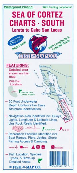
Underwater topography map with GPS grids; depth contours for easy "structure" identification; fish locations; boat ramps, recreational facilities; latitude/longitude for GPS; navigation aids identified. Maps include multiple lakes and are printed on both sides using waterproof plastic material. Loredo to Cabo San Lucas. Underwater depth contours to 30 ft. Folded size: 9"x4". When opened, each map is approximately 3'x2'.
$10.95
Out of stock
| Weight | 0.0875 lbs |
|---|---|
| Dimensions | 8.9 × 4 × 0.5 in |
Only logged in customers who have purchased this product may leave a review.
Reviews
There are no reviews yet.